Hatteras is home to pure Outer Banks living. A day trip to Hatteras is a great way to explore the area that many don’t know about. So, with your day trip to Hatteras, grab your best playlist, hop in your car, roll the windows down, and get on your way to this magical place.
Getting to Hatteras
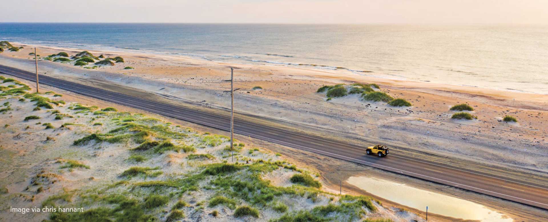
Driving to Hatteras is easy, just get in your head south on Highway 12. Although the main towns of the northern Outer Banks have kept much of their charm, Hatteras is different. The northern OBX area is well developed which is cool that there’s so much around now. However, the real sense of what a barrier island is and how it exists with the sea, begins at the Marc Basnight Bridge. This bridge crosses Oregon Inlet and connects the northern Outer Banks with Pea Island.
Pea Island
Pea Island is the northernmost part of Hatteras Island. It’s a little more than a thread of sand holding back the Atlantic Ocean. The dunes to the east were constructed in the 1930s by the CCC. The CCC (The Civilian Conservation Corps) a Depression era make work program. Today, the dunes are constantly being replenished to protect the road.
To the west there are a series of ponds that are impoundments built in the early 20thcentury. These ponds were used to attract waterfowl for the hunt clubs that populated the Outer Banks. You’ll find a trail around one of them at the Pea Island Visitor Center. It’s about a mile around and most definitely worth the trek.
A little farther down the road lies the Richard Etheridge Bridge that crosses an inlet formed by Hurricane Irene. Before the Richard Etheridge Bridge was constructed, a weird bridge that looks like it was slapped together in a big hurry, used to stand. Although the bridge was actually very well built; the locals gave it the nickname of the “Lego” bridge.
The Tri-Villages
Rodanthe, Waves, and Salvo are known as the tri-villages. This 4 mile stretch is the first string of towns you’ll find on Hatteras Island. Rodanthe is the first of the tri-village stretch. Rodanthe is also the setting for the Nicholas Sparks’ novel Nights In Rodanthe, but it’s so much more than a fictional plot. It’s home to beautiful beaches, prime surfing, and a rich history. On the north end of Rodanthe, you’ll find the Chicamacomico Lifesaving Station. This building may be the best preserved and most complete site of its kind in the country. The Chicamacomico Lifesaving Station is located in a subdivision called Mirlo Beach; named after a British tanker that was sunk off the coast in WWI.
Waves is the middle town of the Tri-Village. It’s full of quaint local shops, eateries, and of course easy beach access. Waves is home to REAL Watersports and is a town full of watersports and spending time on the water.
Salvo is the last (but not least) of the Tri-Villages. It’s about 20 minutes away from Avon/Kinnakeet (we’ll get to that soon don’t worry). Salvo is in a world of its own with uncrowded beaches and residential homes. Blink and you’ll miss it.
Avon (Kinnakeet)
About nine of ten miles south of the Tri-Villages is Avon. Once upon a time, Avon was known as Kinnakeet. Which explains the signs calling out Kinnakeet Shores or Little Kinnakeet. Centrally located, Avon has become the commercial center of Hatteras Island. However, it began its life as a fishing village and there are still remnants of that lifestyle.
Turn right at the light at the intersection of NC-12 and Harbor Road. Follow the road around and it leads to a small commercial fishing dock. It’s a short drive, but it goes right through the core of what was Kinnakeet. There is a clear sense of what the village looked like before commercial development took over. As an aside, the fish market at the intersection gets a lot of its fish from those docks. If seafood is on your menu for dinner, that may be the worth a visit.
For those who aren’t so stoked on seafood, there are a ton of great lunch spots in Avon; the perfect way to break up your trip. Bros Sandwich Shack is a hit as well as Nino’s Pizza. Once you stop and get some grub, get back in the car and keep going south to Buxton.
Buxton & The Hatteras Lighthouse
About 15 miles south of Avon lies Buxton. This Hatteras Island town is the highest point of them all. It’s home to the Buxton Woods Coastal Reserve and the largest maritime forest in North Carolina. Buxton is also home to the heart of Hatteras Island; the Hatteras Lighthouse.
The Hatteras Lighthouse can be climbed and the view is worth the effort–which is considerable. However, climbing is on a first come first served basis, so plan accordingly. For families, children must be at least 42 inches in height and there is a fee. If you have time (or if it’s early enough), take a stop at Orange Blossom Bakery. Their Apply Uglies are one of the most popular menu items. Though they don’t look like much, they’re one of the tastiest pastries you’ll ever try.
Frisco
Frisco is immediately adjacent to Buxton. Frisco is another Hatteras Island town rich in history. Frisco was inhabited by the Croatan Algonquin Indians. Some locals think that Frisco is actually where the Lost Colony fled when the Roanoke Island colony failed. The Frisco Native American Museum is a lot of fun. Exhibits, a short nature walk and occasional activities make it an interesting stop along the way.
For the weird; Frisco is also home to the Futuro House. The Futuro House is right off the side of Highway 12 and is full of UFO inspired decor. It’s one of the few Futuro homes left in the US and it’s definitely worth a photo op.
Hatteras Village
Hatteras Village is at the southern end of the island. Many folks get confused on the difference between Hatteras Island vs Hatteras Village. Hatteras Island is the collection of Rodanthe, Waves, Salvo, Avon, Buxton, and Hatteras Village. Hatteras Village is it’s own little town. It features an eclectic blend of shops, art galleries restaurants. It also features the largest harbor on the island with a substantial fishing fleet-both commercial and recreational. Especially in the fall and winter, when blue water fishing is at its peak, the docks are busy.
At the very tip of Hatteras Village is the Graveyard of the Atlantic Museum. Probably not an all day museum, but some really interesting artifacts and exhibits.
Be sure to stay in the left hand lane when driving to the museum. Bear to the right, and you’ll end up in line for the Ocracoke Ferry. That’s an adventure for another day.


